Drone industry leaders Parrot and CRJ Key Network Partner, Pix4D unite
CRJ Key Network Partner, Pix4D has been working hand-in-hand with Parrot to create solutions for drone mapping and it now offers ANAFI USA’s professional users a large scope of cutting-edge technologies.

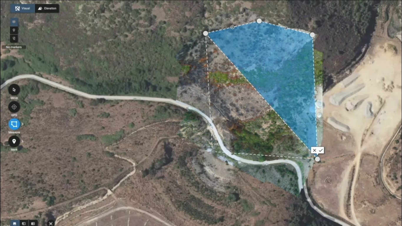
Taken from the video showing how the Pix4Dreact software works. It is invaluable for public safety professionals who want to map specific areas where incidents have occurred.
In recent years, Parrot has been expanding its mature software ecosystem, thanks to its complete Software Development Kit, which facilitates the implementation of tailored and end-to-end solutions by professionals from all around the world – from public safety and search and rescue, to defence and inspection fields.
Pix4D has worked with Parrot to create and innovate these solutions and can now offer ANAFI USA’s professional users a large scope of cutting-edge technologies.
“Working with a member of the group such as Pix4D is always an honour, as we are able to fully leverage the exceptional capabilities and potential of our drones with the best software solutions for each use case. Together we are designing the future of professional drone use,” says Henri Seydoux, Founder and CEO of Parrot.
Christoph Strecha, Founder and CEO of Pix4D adds: “Following Pix4D’s strategy of focusing on creating value for professional users, the compatibility between Parrot’s ANAFI USA and Pix4D’s product portfolio aims to simplify workflows for professional users of drones in surveying, construction and emergency response applications.”
The range of Pix4D software that is now compatible with ANAFI USA:
-
Pix4Dcapture: Easily plan and execute automated drone flights for optimal 2D and 3D mapping and modelling. The app allows first responders to cover an operational area and take the right images for precise measurements to enrich mission reports and improve the preparation of subsequent operations in complex or inaccessible areas;
-
Pix4Dreact: Generate 2D terrain models and maps from images quickly and offline. Emergency response and public safety teams can identify and model priority areas for rapid intervention and detect missing persons or fires, without internet, even in devastated areas following a natural disaster;
-
Pix4Dmapper: 2D and 3D photogrammetry software with many fields of applications and missions: Law enforcement officers can map an accident scene to quickly clear a road; building inspectors can determine with high precision the conditions of buildings and infrastructure; while surveyors can easily and quickly access crucial data, such as extraction volumes;

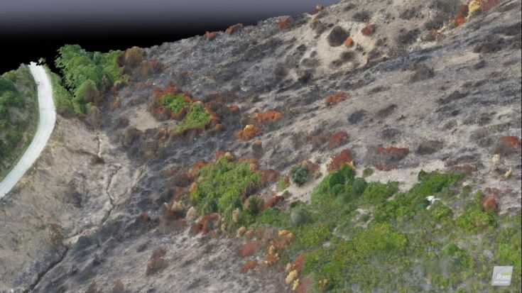
Pix4D mapper in action - the video shows the detail of the terrain that can be mapped in 2-D and 3-D to provide a more than realistic view of a scene
-
Pix4Dcloud: The online platform for drone mapping, progress tracking and site documentation. ANAFI USA’s data combined with the use of Pix4Dcloud provides an affordable and easy way for building site surveyors to map, measure, and monitor the progress of their construction site and to adapt their expectations against project schedules;
-
Pix4Dscan: Professional drone flight app for optimal inspection data, compatible soon with the ANAFI USA. Pix4Dscan guides users to set the right parameters for an actionable dataset, track the mission's progress with map view or monitor live with camera view. Pix4Dscan provides live telemetry data such as altitude, speed, gimbal pitch and more;
-
Pix4Dinspect: Automate industrial inspection and asset management with ANAFI USA’s images. Surveyors can easily and automatically detect cell towers’ antennas and extract their height, dimensions, azimuth, downtilt and plumb; and
-
Pix4Dengine: Pix4D’s processing engine is customised to meet the needs of professionals. It can be hosted on Pix4D’s secure cloud computing server or on the client's side, allowing teams to benefit from Pix4D algorithms with higher flexibility and custom integrations.
Click here for a video of how the software works.
Thumb: Mikhail Grachikov/123rf
For details of how to become a CRJ Key Network Partner, visit our website here or contact Claire or Emily